GPM satellite probes dangerous category 5 Hurricane Irma

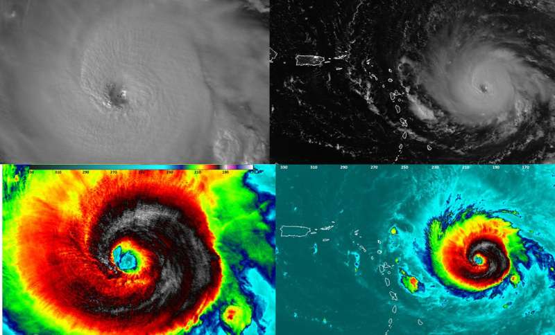
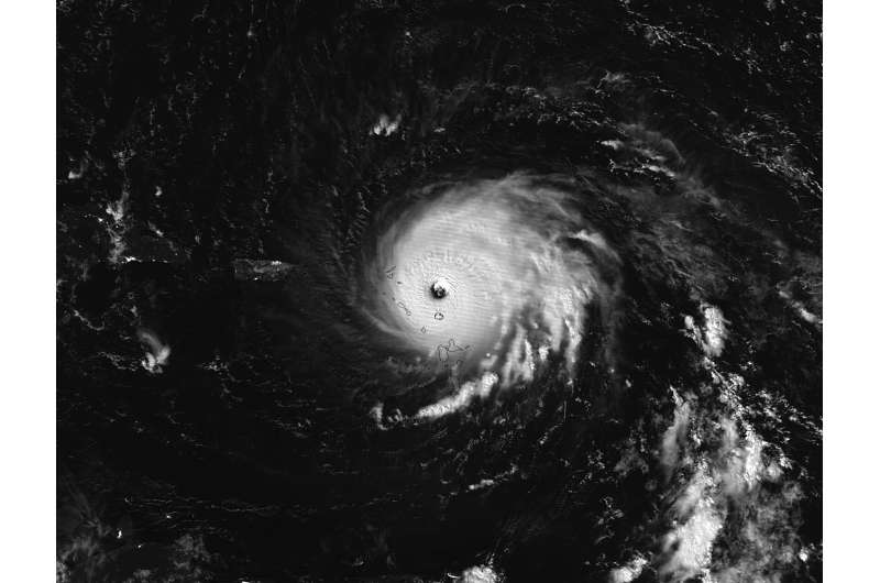
The GPM core observatory satellite had an exceptional view of hurricane Irma's eye and found extreme rainfall within the Category 5 storm's eyewall.
The Global Precipitation Measurement mission or GPM core satellite passed over Irma on September 5, 2017 at 12:52 p.m. EDT (1652 UTC). At NASA's Goddard Space Flight Center in Greenbelt, Maryland a rainfall analysis was created using data from GPM's Microwave Imager (GMI) and Dual-Frequency Precipitation Radar (DPR) data. At the time, Irma was approaching the Leeward Islands with maximum sustained winds of about 178 mph (155 knots). This made Irma a dangerous category five hurricane on the Saffir-Simpson hurricane wind scale. Intense rainfall is shown within Irma's nearly circular eye. GPM's DPR uncloaked precipitation that was falling at a rate of more than 10.8 inches (274 mm) per hour in the solid ring of powerful storms within Irma's eye wall.
At NASA a 3-D image was created using GPM's radar (DPR Ku band) data. GPM's radar revealed that the extremely powerful storms rotating around the eye were reaching altitudes greater than 7.75 miles (12.5 km). The tallest thunderstorms were found by GPM's radar in a feeder band that was located to the southwest of Irma's eye. These extreme storms were reaching heights of over 10.0 miles (16.2 km).
GPM is a joint mission between NASA and the Japanese space agency JAXA.

Warnings and Watches on Sept. 6
A Hurricane Warning is in effect for Antigua, Barbuda, Anguilla, Montserrat, St. Kitts, and Nevis, Saba, St. Eustatius, and Saint Maarten, Saint Martin and Saint Barthelemy, British Virgin Islands, U.S. Virgin Islands, Puerto Rico, Vieques, and Culebra, Dominican Republic from Cabo Engano to the northern border with
Haiti, Guadeloupe, Southeastern Bahamas and the Turks and Caicos Islands.
A Hurricane Watch is in effect for Haiti from the northern border with the Dominican Republic to Le Mole St. Nicholas, Turks and Caicos Islands, Southeastern Bahamas, Cuba from Matanzas province eastward to Guantanamo province, and the Central Bahamas.
A Tropical Storm Warning is in effect for the Dominican Republic from south of Cabo Engano westward to the southern border with Haiti, and a Tropical Storm Watch is in effect for Haiti from south of Le Mole St. Nicholas to Port-Au-Prince.
Irma's Location at 8 a.m. EDT on Sept. 6
At 8 a.m. EDT on Sept. 6, the National Hurricane Center said that the eye of potentially catastrophic category 5 Hurricane Irma was passing over St. Martin and the northern eyewall was pounding the island of Anguilla.
The eye of Hurricane Irma was located near latitude 18.1 degrees north latitude and 63.3 degrees west longitude. Irma was moving toward the west-northwest near 16 mph (26 kph), and this general motion is expected to continue for the next couple of days.
The National Hurricane Center said on the forecast track, the extremely dangerous core of Irma will move over portions of the northern Virgin Islands today, pass near or just north of Puerto Rico this afternoon or tonight, and pass near or just north of the coast of the Dominican Republic Thursday, Sept. 7.
Maximum sustained winds remain near 185 mph (295 kph) with higher gusts. Irma is a category 5 hurricane on the Saffir-Simpson Hurricane Wind Scale. Some fluctuations in intensity are likely during the next day or two, but Irma is forecast to remain a powerful category 4 or 5 hurricane during the next couple of days. Hurricane-force winds extend outward up to 50 miles (85 km) from the center and tropical-storm-force winds extend outward up to 175 miles (280 km). A NOAA National Ocean Service station on Barbuda reported a minimum pressure of 916.1 millibars earlier this morning.
Provided by NASA's Goddard Space Flight Center


